
Return to the Blinded Halfling

While I was living overseas – I’m not sure if this was in 2018 or 2019 but I think mostly the latter – I whiled away the evenings planning a return to my D&D campaign ‘The Blinded Halfling’. I drew maps using pen and ink and digital tools, sketched out character motivations, and chronicled world events. Since then things have fizzled – a lot of my friends have had kids recently, little halflings of their own. So here’s some maps from a campaign that might never be finished – you’re welcome to use them in your own.
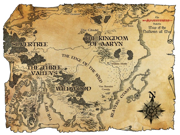
So let’s start with what I think is the definitive map of The Kingdom of Aaryn. Based on a sketch by my friend John – who first led us into our D&D adventures – Aaryn was a mostly quasi-Viking-stroke-medieval land. Over the years it’s become really quite fleshed out with cultural quirks and anachronisms, including the semi-regular publication of The Adventurers’ Bulletin, a newsletter that I used to hide clues about what was going on in the world.
As we left off, Aaryn was being drawn into a war breaking out to the west of a wilderness called The Edge of the Wild. An army of magically corrupted goblins and hobgoblins had conquered The Three Valleys (itself a totalitarian hellscape ruled by devils) and were marching on Wildwood, which I’d pictured as an underpopulated, ungovernable collection of free towns, farmsteads, and pele towers. To the north Silvertree is on the surface a generic fantasy elf enclave, with its own secrets and history. I’m not sure what role, if any, I imagined them playing in the war.
About 15 years ago I was living in Sweden, and got quite interested in Sámi (the indigenous people of northern Scandinavia, Finland, and Russia’s Kola peninisula) history and culture. Sámi shamans would traditionally use a drum of reindeer skin, covered in patterns that reflect the worldview of the owner and his family. These could (according to Wikipedia) be religious or worldly matters: reindeer herding, hunting, householding, and relations with their neighbours.
I wondered how the cultures north of Aaryn might map their world, a world centred on magnetic north, where a day-to-day struggle to survive overlays with generations of oral history and tradition. I also wondered how my friends would use a local map to navigate in-game, and what challenges that might present. This is what I came up with:

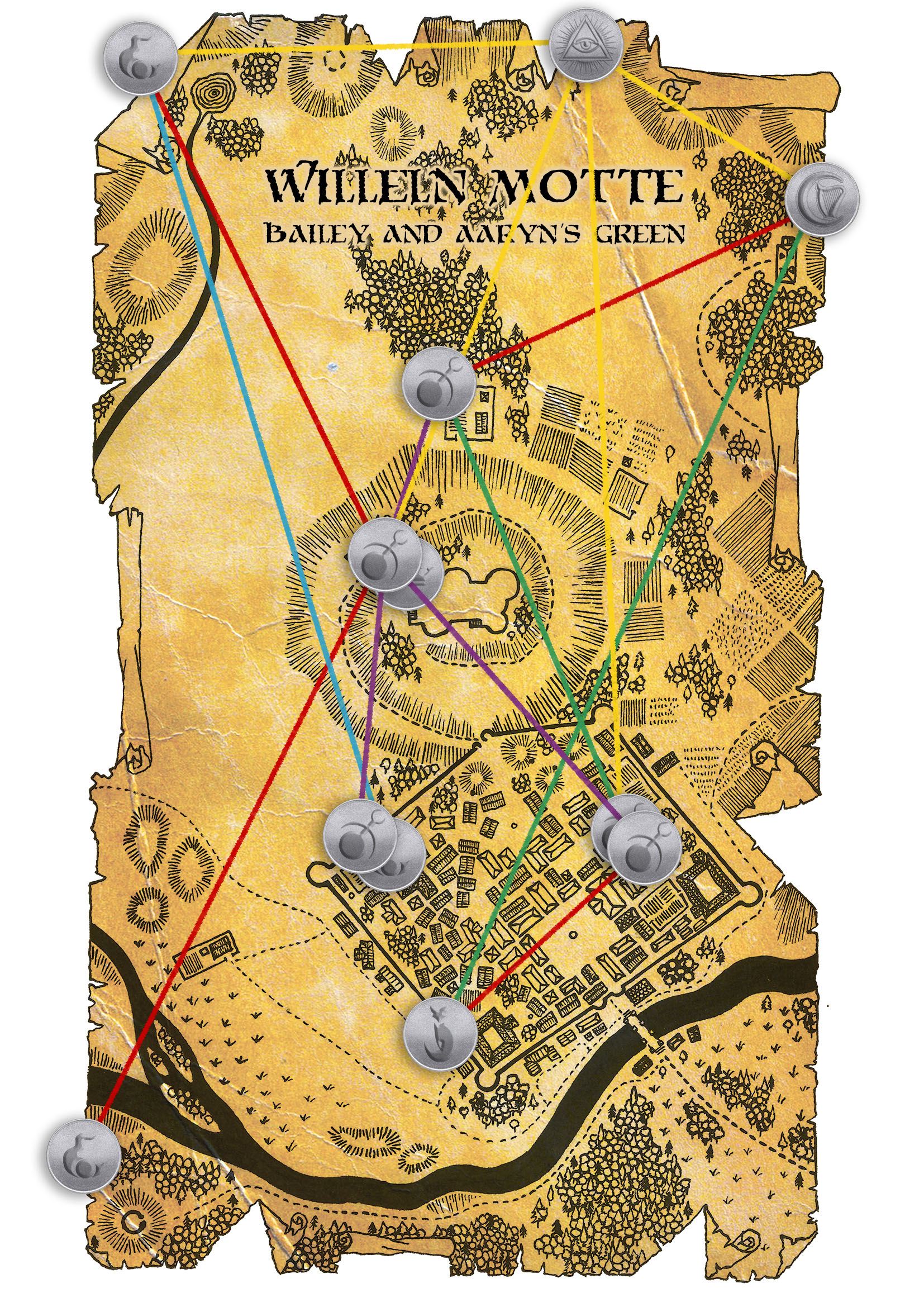
Lastly, here’s two maps of the same settlement, Willeln Motte; one fairly obviously drawn with Inkarnate, the other a mix of pen and digital. Another of John’s original creations, I’d filled this frontier town with competing gangs of cultists and spies, watchmen and reivers, all coming slowly unravelled under the psychic influence of a monstrous creature in the foothills. These groups are represented by a hodgepodge of D&D, Warhammer, and other symbols on the second map. I wanted the maps of the town itself to be fairly loose (so as not to get too bogged down navigating the streets), while picking out a few sites of interest in the surrounding area, to encourage exploration and free-flowing sessions where the players could lead the game.

And that’s more or less all there is. I’m not sure when, or if, we’ll pick the campaign up again. So perhaps this is my last mapmaking post for a while. But if you liked what you read:
- Here’s a link to my previous post on maps and worldbuilding,
- And here’s a link to all my maps, hand-drawn or otherwise.
